Glacier National Park, MT (Many Glacier)

Day 2

Hiking: 15.4 mi / 3000 ft. climbing
Home: Swiftcurrent Motel Cabin

We’re spending a lot of money to be able to explore the Many Glacier valley, so let’s go big before we go home. Wait, we don’t have a home to go to, but soon the Swiftcurrent Motel manager will tell us, like a bartender, “you don’t have to go home, but you can’t stay here”. Before arriving at the park, I semi-randomly came across hikinginglacier.com and quickly settled into using it for trail information in the park, despite never learning anything about its provenance. They have a “Top 10” page, and while of course everyone’s opinion will differ, the unknown author seemed to value similar things as us. The #2-ranked trail (only behind the world-famous Highline Loop) was Swiftcurrent Pass. At over 15 miles round-trip from our cabin door, it would be the longest hike we’ve ever done, but we’re trusting that our two previous double-digit hikes here frightened our nonexistent hiking muscles into taking emergency action to get into shape.

We got breakfast at Nell’s as soon as they opened, and, properly fueled, were quickly on our way to the trail that conveniently starts right from the motel complex. Cool and green to start, we went five miles tracing a line of lakes along the valley floor, rising not even 300 feet. The views of the mountains encircling and rising nearly 4000 feet above us were astounding, but the most-unbelievable thing was that this trail would somehow take us up and over the most beautiful dead-end I’ve ever seen in my life.

Glacier’s beauty is not entirely natural: someone goes around each morning and bedazzles the plants with Swarovski crystals.
(One part of?) Redrock Falls. We didn’t really have space in our energy budget to explore, we had many more miles to hike!
In the morning the mountaintops kept themselves encircled with clouds, just to let us know how tall they were.
This Colombian Ground Squirrel’s job is to go around and give a kiss to every flower in the valley.
Today is the Fourth of July, and the park was thoughtful enough to provide fireworks, in red, white, and blue.
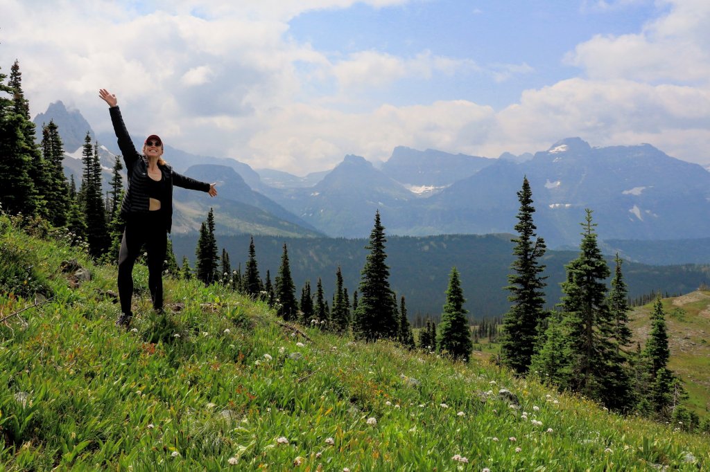
The waterfalls more than 1000 feet above Rett’s head turn into the creek running below her feet. And this is the point where we leave the valley floor and being climbing the wall.

A series of switchbacks pushed us inexorably upwards, but never at a slope that winded us too badly. The perspective became airplane-like, and never has flying like a bird seemed more-attractive.

Hey, we’re already up pretty high!
Marmots really like to pose for dramatic photos.

There is a giant pile of rocks marking the pass at the Continental Divide and the “end” of this named hike, but hikinginglacier.com helpfully recommended continuing on another quarter-mile down to the other side, because there we see an entirely new world, the even grander McDonald valley, and a preview of what we would see if and when we did the Highline Trail. There we had lunch on the rocks, marveling at the endless mountains. What we did not do was climb an extra 1500 ft. up to the Swiftcurrent Fire Tower (using the highest-elevation maintained trail in the park), because we’re finally wise enough to not extend ourselves that far.
A whole new valley lies on the other side of Swiftcurrent Pass.
One of the flanks of Mt. Gould, or part of “The Garden Wall” defining the Continental Divide here. Or, a powerful wizard’s castle.
On this west side of the Continental Divide, the Hills Are Alive With the Sound of Music (Heavens Peak standing in for the Swiss Alps).

Backtracking over to “our” side of the pass, the return hike was perhaps even better, as the skies had opened up more, and we had a better of understanding of what we were even looking at in this three-dimensional space that challenges human comprehension. We started seeing a few more people, but overall the trail was nearly empty, just the way we like it. One of those people was Jonathan, a University of Wisconsin environmental professor taking an appropriate sabbatical trip to the park, who, wiser-than-us, had decided to turn around only halfway up the pass, to live to hike another day. We leapfrogged on the way down several times, but then joined forces to “race” the last couple miles together.

While I’m not yet at a loss for words, from this point on, the photos can tell a better story than I can. So I’ll let them take us back to the cabin, where we ended footsore and tired, but extremely satisfied. After some wildly-high expectations that didn’t quite get met for Rett on our first two on-foot forays in Glacier, she declared Swiftcurrent Pass to perhaps the best hike she’s ever done, even surpassing an autumn circuit of Maple Pass Loop in Washington. And I couldn’t find any reason to disagree with that. On this July 4th, in this National Park, all I can say is “America, Fuck Yeah!”

Coming back to the east side of the Continental Divide, the clouds have lifted a bit for our hike down.
#FindRett walking on the other side of a steeply-falling creek from me.
#FindRett rounding the nose of this mountain on the trail 1200 ft. above the valley floor.
A closer view just in case you couldn’t find her in the wider photo.
The view from the spot on the nose of the mountain where Rett was standing, once I finally caught up to her again.
“The Eagles…the Eagles are coming!” -Peregrin Took, Lord of the Rings (and it’s not just the Middle-Earth mountains that make this scene perfect, this is a golden eagle, the species on which the giant eagles of the movie seem to be modeled on. Also the first golden eagle I’ve seen in my life, and I doubt I’ll ever see one in a better place!)
Maybe “only” 1000 feet down to that green valley floor at this point.
Swiftcurrent Glacier, the first proper glacier we’ve seen in Glacier National Park.
Three sections of Bullhead Lake, and then Redrock Lake.
Rett doing her best marmot/mountain goat impression.
Hey, I’m doing this hike too, cool! (© Rett)
Always plenty of small-scale beauty as well.
Down into the green again.
I don’t even know what to write. Just look at this. And then come here to experience it yourself!
Oh man, now they come in a duo? (Really there was a trio, but the 3rd part of their act wasn’t very well trained).
Bullhead Lake, Mt. Grinnell, and the glacial bowl that we somehow climbed up and over.

Posted

in

, ,

by

Last Updated:

Comments

2 responses to “Glacier National Park, MT (Many Glacier)”

  1. Mary Gilliam Avatar

    Oh my! We are coming as a first family trip since our 3 married many years ago! We are 78/80 and so want to see the beauty of this park to our utmost! We can’t go 15 miles any longer but think we have maybe 3 each day in us. Any tricks/tips for us would be apppreciated. Hubby just got a new knee 3 months ago! Trekking poles are coming with him.

    1. neil Avatar
      neil

      In Many Glacier, anything around Swiftcurrent Lake and Lake Josephine is flat and gives you great views with very little mileage. There are also boat rides you can take across the lakes, both in Many Glacier and Two Medicine that can bring you further out without effort, or be just a way on their own to see the valleys. Up at the top, at Logan Pass, going south the Hidden Lake Trail is short and spectacular, and wide boardwalks most of the way (though it does climb quite a bit). And going north from Logan Pass, the Highline Loop is 11.4 miles long, but just doing the first mile or two and turning around will be enough to bring you some of the best views. And yes, even with our original and ~35-years-younger knees, we still wish we were able to carry our trekking poles with us on the bikes!

Leave a Reply

Your email address will not be published. Required fields are marked *